About
This map illustrates the nitrate concentrations in production wells. The contents of this analysis overlays the map of the Northern Guam Lens Aquifer (NGLA).
Updates
Last updated in 2021.
Web Map App
See some of the viewing options of the map below:
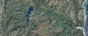
Mobile View
Desktop View
Desktop View
Downloadable Map Content
Click on one of the tabs below to view a list of shape files or raster files available for you to download.
Basement topography | Elevation contours, meters, Vann, Bendixson, Habana 2018
Basement contours | Select contours 0, -20, -40 meters
Saltwater toe extracted from groundwater model | No pumping, 50% isochlor, Gingerich 2014
Aquifer basins 2021 | Basement and flow line delineation, from Gingerich 2013 model
Water table contours | No pumping condition, from Gingerich 2013 model
NGLA Map 2021 | Basic shapefiles package
Links to these files are currently under construction. Please check again later.