About
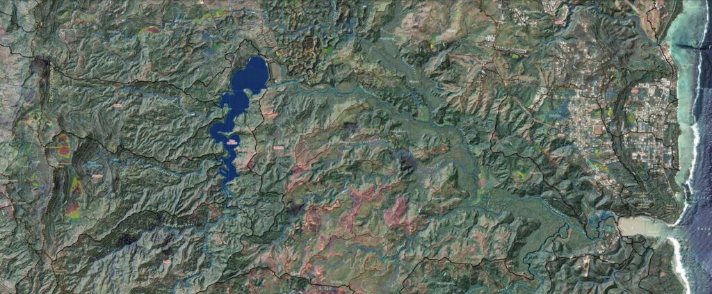
This is the first version of the highest-resolution hydrologic map of Guam's watersheds. The analysis builds on recent terrain and hydrologic studies of the Northern Guam Lens Aquifer, particularly the Surface Hydrology of the Northern Guam Lens Aquifer (WERI Technical Report 175), and continues through an iterative process that delineates runoff paths within surface depressions. The final stage—assigning place names to hydrologic features—is currently underway in collaboration with the Kumision I Fino’ CHamoru and the Kumision I Na’an Lugat Guåhan team. The technical report for this hydrologic product is also underway.